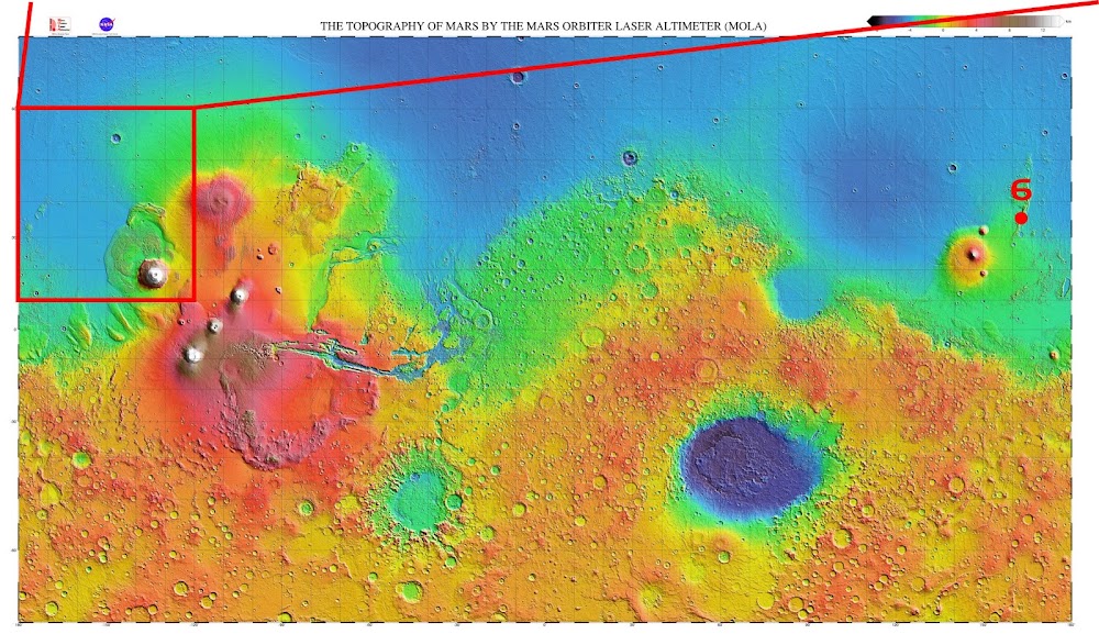
Robert Zimmerman from BehindTheBlack.com has found several images labelled as "Candidate Landing Site for SpaceX Starship [..]" in the latest data release from University of Arizona's HiRISE camera (aboard NASA's Mars Reconnaissance Orbiter). It means that with help from NASA SpaceX is already quietly evaluating the best place where to land first Starships on Mars. Here are direct links to HiRISE image of: Site 1, Site 2, Site 3, Site 4, Site 5 (in Arcadia Planitia) & Site 6 (in Phlegra Montes).
For several years it hasn't been a secret SpaceX is considering four Martian regions for landings: Deuteronilus Mensae, Phlegra Montes, Utopia Planitia and southern Arcadia Planitia. But even in 2017 southern Arcadia Planitia looked "more promising", according to Paul Wooster, Principal Mars Development Engineer at SpaceX. So by now SpaceX may very well be down to evaluating more precise landing sites in that region.
All the candidate landing sites (except #6 in Phlegra Montes) are located on the border between Amazonis Planitia and Arcadia Planitia. According to latest data, Arcadia Planitia is one of the few regions where abundant shallow ice is present at relatively low latitudes. There is strong evidence that this location holds buried ice glaciers. So it has two critical elements looked by SpaceX for its Mars Base Alpha: solar energy and water. Those are critical not only for life support but also for refueling Starships. It's also in low altitude meaning a bit higher air pressure than in higher areas on Mars; that is beneficial for radiation protection and creates more atmospheric drag during the landing.
We made a map of all of the candidate sites:


Fantastic! Old, collapsed lava tubes maybe near there too? An emergency underground Safe Haven needs to be considered while the Alpha Base is being fitted.
ReplyDeleteWouldn't the lowest elavation have a thicker atmosphere to offer some protection from radiation?
ReplyDeleteYes, a little. But we are talking there about the difference in tenths of percent prom Earth's atmospheric pressure.
DeleteAlso means that Starship landings will require significantly less delta V, as the atmosphere can do the vast majority of braking.
DeleteWhy not Camp 4 near to Kanchenjunga, 26,000 ft savig
ReplyDeleteThat's on Everest?
ReplyDeleteWhy does the map not have any distance (in miles or kilometers) legend though? Just how far are those landing sites from Olympus Mons for example?
ReplyDeleteBack of the envelope: Each block vertically is 10 degrees of latitude, which would by definition be 600 nautical miles on earth.. but divide by the earth/mars diameter ratio, 1.88, and it's 391 nautical miles, or 591 kilometers between the horizontal lines.
DeleteNot removing anything from Carolyn's comment... she did the work.
Deletei found, this: https://trek.nasa.gov/mars
at 40 degrees... it's 281m (because of curvature).
Which thing is 281 km? If you had to account for lattitude in your number, then you are not talking about the same thing.
DeleteWould the first 100 be able to see Olympus Mons on the horizon from these potential locations?
ReplyDeleteNo. It's too far & the horizon on Mars is closer because of smaller radius of Mars.
Delete